Our Drone Services for Agriculture and Land Management in Wales
At Tropos Drone Services Ltd, we provide expert drone solutions tailored to the needs of modern agriculture, forestry, and land management professionals across Wales. Our team of CAA-certified pilots and ground crew—each with farming backgrounds—combine technical precision with real-world understanding of the land. From crop scouting and aerial spraying to detailed field mapping and lake surveys, we offer services that save time, reduce waste, and deliver valuable data for smarter decisions and healthier yields.
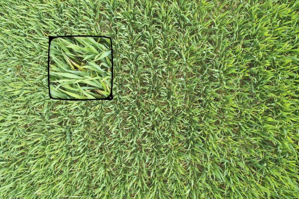
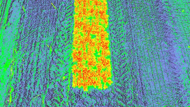
Crop Scouting
Field Overview Captured in a few minutes.
Our AI supported software takes photographs of your crop to help you spot disease, pests and weeds. It is a faster way to walk your crop that offers high resolution, leaf-level images for you and your agronomist to review. Our Multispectral drone can also provide data that we can process as variable rate application maps for our spray drone or indeed various makes of tractor, depending on file transfer protocols.
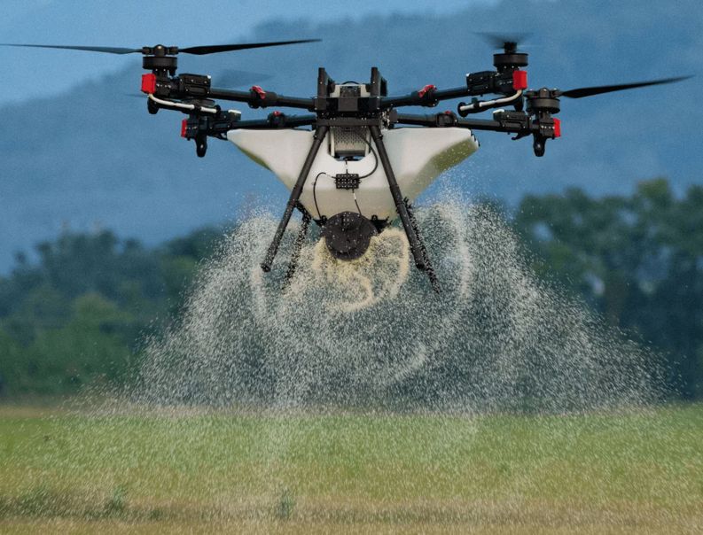
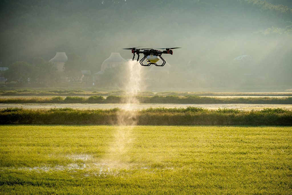
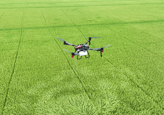
Spraying and Spreading
When it comes to spraying and spreading with drones, we have hands-on experience using advanced agri-drones for these specific tasks. We’ve utilised drones equipped with precision spraying technology to efficiently apply non MAPP registered applications across large fields. This method ensures uniform coverage, reduces waste, and minimises the environmental impact by targeting specific areas. In addition to spraying, we have experience with drone-based spreading, including the distribution of fertiliser, seeds or granular materials, (including Cover Cropping) optimising both time and resource use in agricultural operations. These technologies allow for more precise and efficient management of crops and land.
Unlocking Landscapes: Master Field Mapping!
Data Integration and Decision Support
Yield Mapping: When combined with yield data, field boundaries become a critical component of analysing which parts of a field are most productive and where interventions may be needed.
Irrigation Planning: Advanced mapping can identify optimal irrigation strategies, ensuring that water is distributed efficiently across the field, especially in areas with varying soil types or slopes.
Soil and Weather Data Integration: Integrating field boundary maps with real-time soil moisture sensors and weather forecasts allows for precise irrigation scheduling and better overall field management.
Benefits of Advanced Mapping and Field Boundary Management
Increased Efficiency: Helps reduce waste in inputs like seeds, fertilisers, and water.
Enhanced Yield: By monitoring and managing each part of the field precisely, overall productivity increases.
Environmental Protection: Reduces runoff of chemicals into nearby water bodies by accurately applying fertilisers and bio stimulants only where needed.
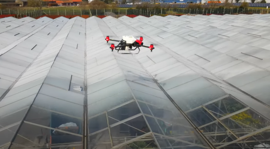
Greenhouse Shading with our innovative drone spraying solution.
We also contract our services to QuadRotar Systems https://www.quadrotor.co.uk/ where our drones deliver greenhouse shading with precision accuracy, targeting the areas where it is required and importantly safely. Removing the need to have workers crawling along the gutter whilst pulling a hose pipe. Minimising paint waste and optimising the distribution of greenhouse shading. Our drone spraying technology can cover up to 1 hectare per hour, making this method safer and faster compared to traditional methods.
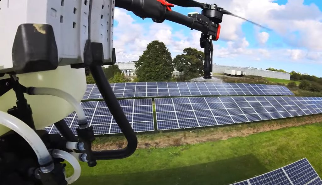
Solar Panel Cleaning
Our drones prevent the need for workers to climb ladders or work on roofs, minimizing accidents. They quickly cover large areas, making them perfect for cleaning extensive solar farms and reducing down time. Drones can reach panels that are inaccessible with traditional methods, for example, steep slopes or wet conditions.. Our solution uses specialised biodegradable cleaners designed for solar panels, ensuring effective cleaning without harming the environment. Regular cleaning can help prevent damage to solar panels caused by accumulated dirt and debris.
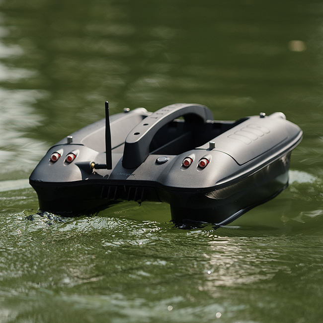
Lake Mapping
Lake mapping with sonar involves using sonar-equipped drones or boats to gather detailed data on underwater terrain, depth and topographical features. Sonar technology sends sound waves to the bottom of the lake and measures the time it takes for them to return, allowing for accurate depth readings and mapping of the lake bed. This method helps in creating high-resolution, 3D maps of underwater landscapes, which can be used for ecological studies, resource management, or recreational planning. It provides precise and efficient surveying, even in areas that are difficult to access.
A bathymetric map is a detailed representation of underwater terrain, similar to a topographic map, but for bodies of water.
Book professional drone services today for precise crop scouting, spraying, and mapping across Wales and beyond.

Revolutionise Your Farming. Get in Touch Today!
© 2025 Tropos Drone Services Ltd